Wood Buffalo is one of the most distinctive regions in northern Canada – a place where wide boreal landscapes, lakefront settlements, and long-standing Indigenous communities shape everyday life. Although Fort McMurray is the region’s main urban hub, much of Wood Buffalo’s identity comes from its smaller rural and First Nation and Métis communities, each carrying its own story, traditions, and relationship with the land.
This overview brings together essential facts, regional data, and locally recognized characteristics to give readers a clear and respectful understanding of these communities and the role they play within the wider Wood Buffalo area.
How We Prepared This Information
This overview was prepared by reviewing publicly available regional statistics, municipal summaries, and long-established community information. Each profile was written to reflect widely recognized characteristics, avoiding assumptions and ensuring cultural respect. The goal is to offer a clear, accessible overview based on reliable sources while encouraging readers to consult official channels for the most detailed and current information.
Key Facts About Wood Buffalo: People, Land, and Regional Trends
Adding a broader look at Wood Buffalo helps place each rural community in context. The region is unique in scale, population patterns, and cultural composition, which all shape daily life in the northern communities.
Population & Demographics
- The Regional Municipality of Wood Buffalo has approximately 84,000 residents (2025 municipal estimate).
- Fort McMurray makes up most of the population, while the rural and Indigenous communities together represent roughly 6-7% of the total.
- Wood Buffalo also has one of the youngest populations in Canada, with a median age of around 33 years – much lower than the national median of ~41.
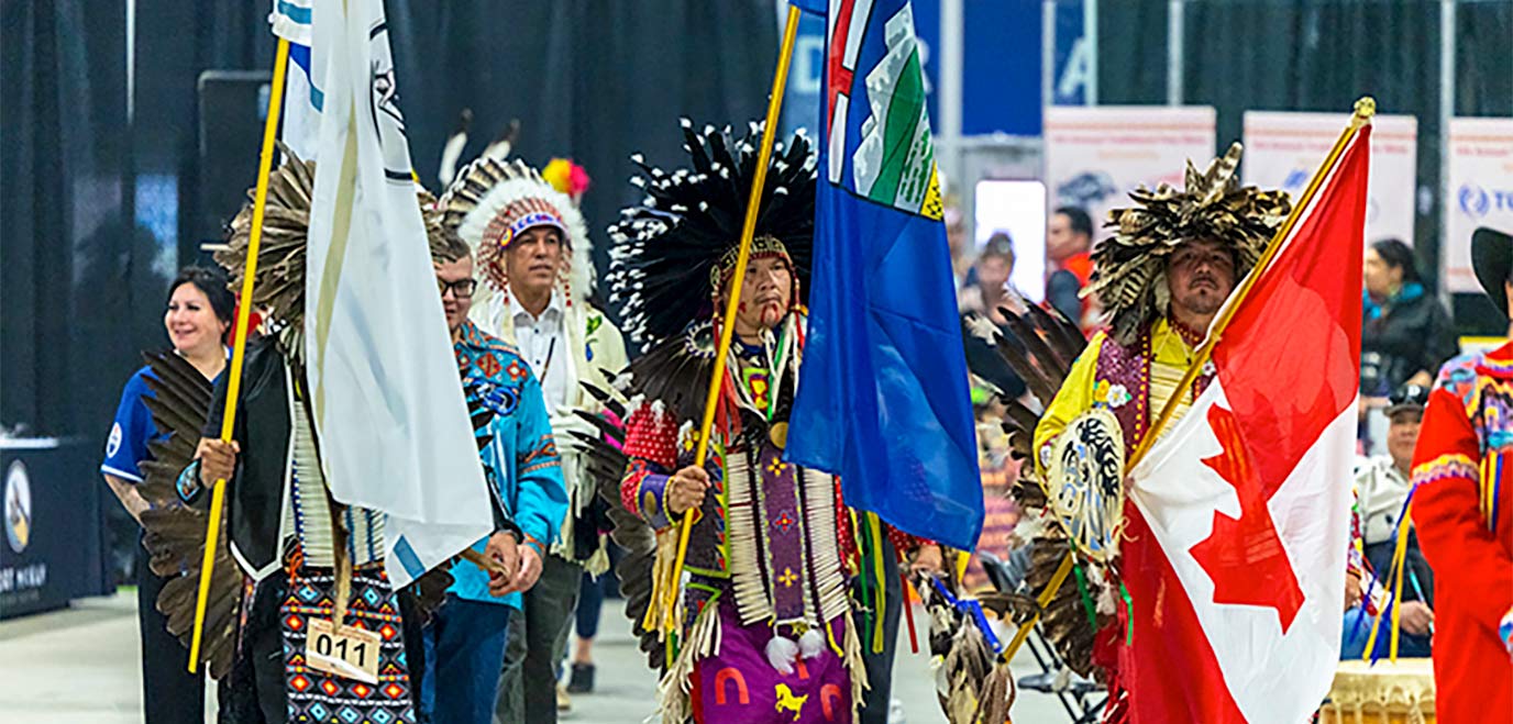
- Indigenous peoples (Cree, Dene, and Métis) form a significant portion of the rural community population, with some settlements being 80-95% Indigenous.
Geography & Land Area
- Wood Buffalo covers nearly 68,500 km², making it larger than Nova Scotia and one of the largest municipalities in North America.
- The region includes major natural landmarks such as:
- Wood Buffalo National Park, a UNESCO World Heritage Site
- Lake Athabasca, one of the largest lakes in Canada
- Immense boreal forest zones, wetlands, and wildlife corridors
Access & Transportation
Because many communities are remote, access varies widely:
- Fort Chipewyan has no permanent road access – residents rely on winter roads, boat travel, and flights.
- Janvier, Conklin, and Anzac are accessible via Highway 881 or secondary regional roads.
- Saprae Creek and Gregoire Lake Estates sit close to the highway system with direct access to Fort McMurray.
- Seasonal road conditions and forest-fire risks often influence mobility across the region.
Local Economy
- Wood Buffalo is Canada’s centre for oil sands operations, and many residents in rural areas work rotational or project-based jobs connected to this industry.
- Indigenous-owned corporations – especially in Fort McKay – generate hundreds of millions in annual revenue, making the area one of the most successful Indigenous economic hubs in Canada.
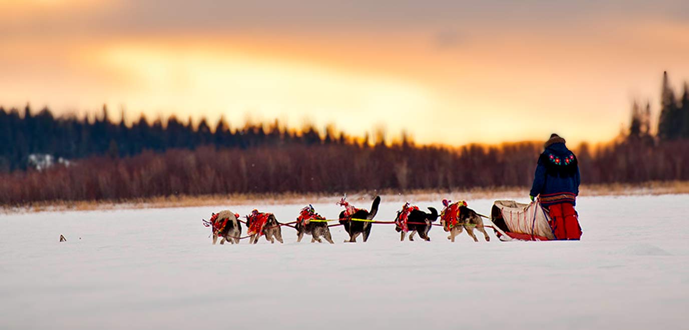
- Traditional activities such as hunting, fishing, and trapping remain important sources of food security and cultural continuity.
Climate & Environment
- The region experiences long winters and short summers, with average January temperatures often reaching -20°C to -25°C.
- Wildfire activity is a recurring seasonal challenge; the 2016 Horse River wildfire remains one of the largest evacuations in Canadian history.
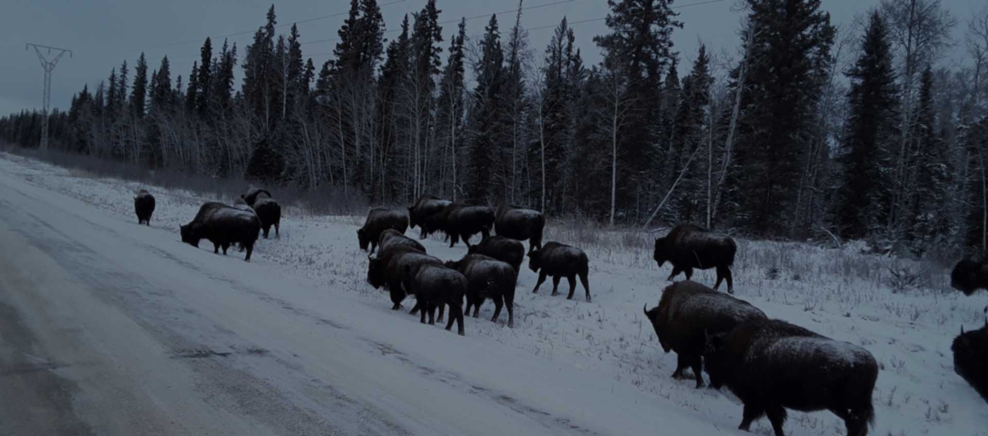
- Wood Buffalo is known for northern wildlife, dark-sky viewing, and outdoor recreation such as snowmobiling, boating, and ice fishing.
Sources Consulted
- Regional demographic summaries from publicly available Wood Buffalo municipal reports (2024-2025).
- Population and age-distribution data from Statistics Canada’s latest census and community profiles.
- General geographic and land-area information from Government of Alberta regional overviews.
- Environmental and climate details from Environment and Climate Change Canada’s northern Alberta climate records.
- Background on Wood Buffalo National Park from UNESCO’s publicly available site description.
These environmental conditions shape not only the landscape but also the daily rhythm of life across Wood Buffalo’s rural and Indigenous communities. Each settlement has adapted to the region’s northern climate in its own way, developing unique traditions, local practices, and community strengths. With this broader context in mind, we can now take a closer look at the individual communities and what makes each one distinct within the wider region.
Communities Across Wood Buffalo: Local Profiles and Key Highlights
Each community in Wood Buffalo has its own character, shaped by local traditions, geography, and the strong ties residents maintain with the land. The following profiles offer a closer look at these rural and Indigenous areas, highlighting what makes each place unique within the region.
Fort Chipewyan
Fort Chipewyan remains one of Alberta’s oldest northern settlements, and many visitors search for Fort Chipewyan Alberta to learn its long history. The community sits on the northwest shore of Lake Athabasca and is known for its deep cultural connections to Cree, Dene, and Métis traditions. Local heritage sites, including the small but meaningful Fort Chipewyan Museum, help preserve stories from the fur-trade era. Life in Fort Chipewyan continues to revolve around seasonal travel routes, harvesting practices, and the area’s strong sense of community identity.
Anzac
Anzac Alberta is a quiet lakeside community just southeast of Fort McMurray. Often referred to simply as Anzac, it attracts residents who enjoy a balance between country living and easy access to the city. Located near Gregoire Lake, it offers year-round recreation, community events, and a laid-back lifestyle that appeal to families and outdoor enthusiasts.
Conklin
Surrounded by dense boreal forest, Conklin Alberta is a community with deep Cree and Métis roots. Known locally as Conklin, it is a place where traditional activities – hunting, fishing, berry picking – remain part of everyday life. The community’s location along Highway 881 provides access to neighbouring settlements while preserving its quiet, land-based character.
Fort McKay
Fort McKay is well known for its strength as an Indigenous community and its location along the Athabasca River. Many readers often wonder where is Fort McKay Alberta, reflecting the community’s remote northern setting. Its economic success has become a national example of Indigenous business leadership.
Fort Mackay (Alternative Spelling)
Some maps and searches also use the spelling Fort Mackay, including variations like Fort Mackay AB and Fort McKay Alberta. Regardless of spelling, the community maintains strong Cree, Dene, and Métis traditions, supported by cultural programs and land-based learning.
Gregoire Lake Estates
Gregoire Lake Estates sits near the shoreline of Gregoire Lake and offers a peaceful residential setting surrounded by nature. Its location provides quick access to outdoor recreation and strong ties to nearby First Nation communities. Many residents choose this area for the quiet lifestyle and close community connections.
Janvier (Chard)
Located south of Fort McMurray, Janvier Alberta is a predominantly Indigenous community where Dene and Cree traditions continue to guide daily life. Seasonal gatherings, cultural teachings, and family networks play a central role. Travel between Janvier Alberta to Fort McMurray is common for work, schooling, and services, with residents maintaining close ties to the wider region.
Fort Fitzgerald
Known historically as a northern river settlement, Fitzgerald Alberta – often referred to simply as Fort Fitzgerald – sits near the border with the Northwest Territories. Its population is small, but the area remains significant due to its connection to early transportation routes and the Athabasca River’s historic portage system.
Saprae Creek
Saprae Creek is a residential area southeast of Fort McMurray known for its quiet environment, active community life, and proximity to the Clearwater River Valley. Many families appreciate the balance between rural living and quick access to urban amenities.
Community | Location & Surroundings | Cultural / Community Notes | What It’s Commonly Known For |
|---|---|---|---|
Fort Chipewyan | Northern shore of Lake Athabasca | Strong Cree, Dene & Métis heritage | One of Alberta’s oldest settlements, local museum, historic fur-trade roots |
Anzac (Alberta) | Near Gregoire Lake, southeast of Fort McMurray | Family-oriented community with access to nature | Lakeside recreation, quiet rural living |
Conklin (Alberta) | Along Highway 881, surrounded by dense boreal forest | Deep Indigenous roots; traditional land use remains common | Hunting, fishing, berry picking, secluded forest setting |
Fort McKay / Fort Mackay | North of Fort McMurray along the Athabasca River | Cree, Dene & Métis community with strong local leadership | Indigenous economic success stories; cultural programs; river access |
Gregoire Lake Estates | Close to Gregoire Lake and major recreation areas | Close ties to nearby First Nation communities | Lakeside living, nature access, quiet residential environment |
Janvier (Alberta) / Chard | South of Fort McMurray, forested setting | Predominantly Indigenous community; strong Dene & Cree traditions | Cultural gatherings; land-based practices; travel link to Fort McMurray |
Fort Fitzgerald (Fitzgerald Alberta) | Near the NWT border, historically remote settlement | Small community tied to northern river history | Heritage of early transportation routes and portages |
Saprae Creek | Southeast of Fort McMurray near the Clearwater River Valley | Active residential community with rural character | Family living, outdoor recreation, quick access to city amenities |
Together, these communities help show what everyday life looks like across Wood Buffalo, from local traditions to the realities of northern living. This article offers only a general overview based on publicly available information and should not be seen as an official source. We are not an official website for Wood Buffalo or its communities, so anyone needing detailed, current, or community-specific updates should always refer to the region’s official municipal resources and local authorities. Our goal is simply to help readers better understand the area in a clear, accessible, and responsible way.
Disclaimer: This article is an independent, non-official overview created for general informational use. It does not represent or speak on behalf of the Regional Municipality of Wood Buffalo or any local community. Readers seeking official updates or detailed community information should refer to municipal publications and local authorities.